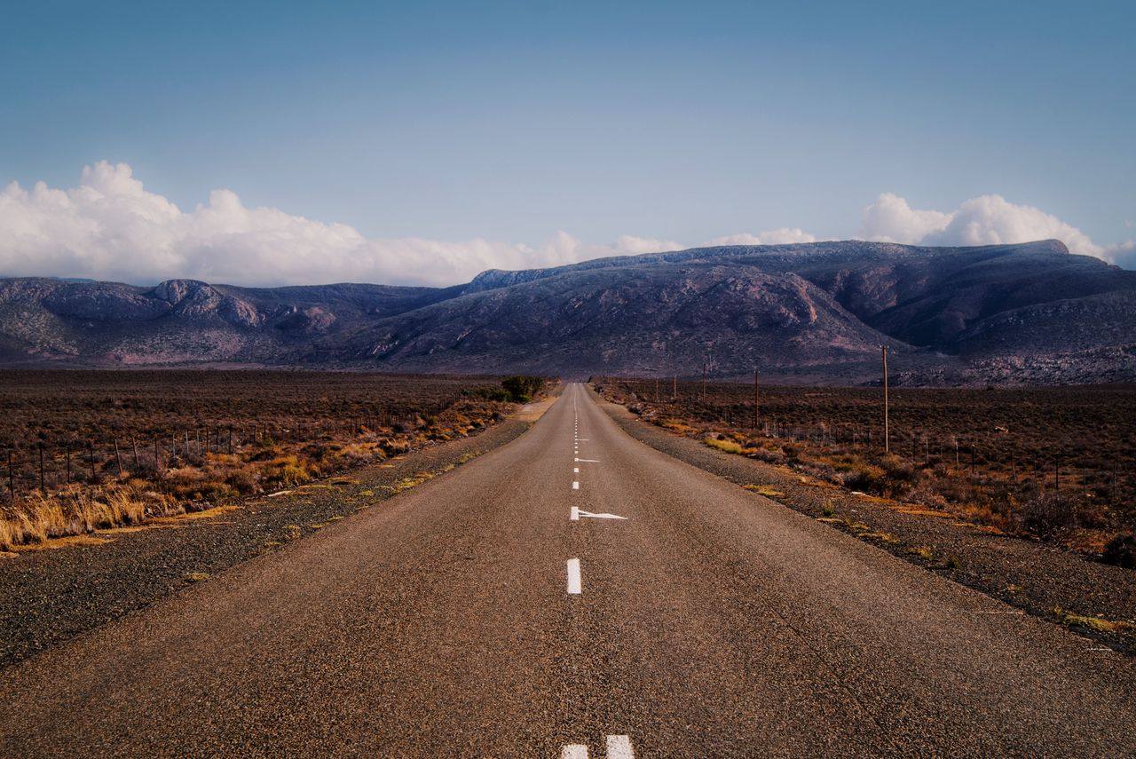
The drive from Cape Town to Johannesburg via the N1 is one of South Africa’s great inland road trips. At roughly 1,400km through the heart of the Great Karoo, it trades coastal scenery for something altogether more arresting: vast semi-desert plains, fossilised riverbeds, Victorian railway villages, and a sky so wide it feels theatrical.
This is not a race. The Karoo rewards drivers who slow down, step out of the car, and actually look at the landscape. Done properly over two or three days, the N1 route delivers some of the most memorable stops in the country.
Route Overview
The N1 runs almost directly northeast from Cape Town through the Western Cape mountains, across the Central Karoo plateau, and up into the Northern Cape before climbing onto the Highveld toward Gauteng.
| Leg | Distance | Driving Time |
|---|---|---|
| Cape Town to Paarl | 60km | 45 min |
| Paarl to Worcester | 45km | 35 min |
| Worcester to Matjiesfontein | 170km | 1h 45m |
| Matjiesfontein to Beaufort West | 195km | 2h |
| Beaufort West to Three Sisters | 115km | 1h 10m |
| Three Sisters to Richmond | 16km | 15 min |
| Richmond to Hanover | 85km | 55 min |
| Hanover to Colesberg | 105km | 1h 05m |
| Colesberg to Johannesburg | 480km | 5h |
| Total | ~1,400km | 13-14h driving |
Allow at least two driving days for a comfortable trip. Three days is ideal if you want to explore the Karoo towns rather than simply passing through them.
Cape Town to Paarl and Worcester
Leave Cape Town early to beat the morning rush on the N1. The highway climbs steadily out of the city, past the sprawling townships of Bellville and the wine estates around Kraaifontein, and delivers you into the Paarl Valley within 45 minutes.
Paarl (60km from Cape Town) is worth a brief stop for fuel and coffee. The long main street is lined with Cape Dutch homesteads and the granite boulders of Paarl Mountain rise behind the town. The Afrikaans Language Monument on the hill above town is unusual, and the winelands around Paarl are arguably less crowded than Stellenbosch. If you plan to overnight in the winelands before pushing into the Karoo, this is a good base.
From Paarl, the N1 continues to Worcester (105km from Cape Town), the last significant town before the mountains close in. Fill up with fuel here and stock up on snacks. The Karoo stretches ahead for several hundred kilometres with limited services.
Hex River Pass
Just east of Worcester, the N1 climbs through the Hex River Pass, one of the most spectacular sections of the entire route. The road rises sharply through a narrow valley carved between bare quartzite peaks, passing vineyards that somehow survive on the valley floor. In April, the vine leaves turn orange and red against the grey rock faces. The pass crests at around 900m before the highway descends onto the Karoo plateau.
The change on the other side of the Hex River Mountains is dramatic. Within a few kilometres, the vineyard green disappears entirely, replaced by flat scrubland and the distinctive low, rounded shapes of Karoo kopjes.
Matjiesfontein: First Overnight Stop
Distance from Cape Town: 240km Driving time: 2h 30m
Matjiesfontein is one of the strangest and most charming stops on the entire N1. A Victorian railway village preserved almost entirely intact, it sits in the middle of the Karoo looking exactly as it did when Scottish railway entrepreneur James Logan built it in the 1880s as a health resort for Cape Colony residents.
The whole village is essentially a single street: the red-brick Lord Milner Hotel dominates one side, with a post office, museum, and tea room completing the scene. The hotel’s bar is a proper period piece — tin ceilings, framed portraits, long wooden counter. The museum in the old post office covers the Anglo-Boer War history of the area and the remarkable story of Logan himself.
What to do in Matjiesfontein:
- Tour the village on one of the red double-decker London buses that operates short circuit rides
- Visit the Laird’s Arms bar in the Lord Milner for lunch or dinner
- Walk the short distance to the N1 underpass and out into the open Karoo — the silence and scale are something else at dusk
- Look up. Matjiesfontein has almost no light pollution and the night sky here is extraordinary
Overnight: Lord Milner Hotel — rooms from approximately R1,200/night. A genuinely historic property and the obvious choice. The restaurant serves reliable Cape cuisine.
Fuel note: Matjiesfontein has a filling station on the N1 service stop. Fill up before continuing east.
Matjiesfontein to Beaufort West
This 195km stretch is classic deep Karoo. The road is wide, straight, and largely empty. Flat-topped mountains called koppies punctuate the horizon, and the scrubby vegetation of Karoo vygies and succulents stretches to every edge of vision.
Three Sissies / Drie Susters Koppies appear about 20km east of Matjiesfontein — three symmetrical rocky hills that rise abruptly from the flat plain. They are one of the most photographed geological features in the Western Karoo.
Watch for blue cranes (South Africa’s national bird) feeding in the roadside verges through this section. They are common here and easy to miss at highway speed.
Beaufort West: Second Overnight Stop
Distance from Cape Town: 475km Driving time: 5h from Cape Town / 2h from Matjiesfontein
Beaufort West is the largest town in the Karoo and the main service hub on the N1 between Cape Town and Johannesburg. It sits at the centre of the Karoo National Park and is worth at least a half-day stopover.
What to do in Beaufort West:
- Karoo National Park — the entrance is just outside town. Day entry is approximately R244 per adult (international visitors, 2025/26 SANParks rates). The park protects classic Great Karoo ecosystem with black rhino, Cape mountain zebra, gemsbok, and springbok. A 2-3 hour self-drive loop is enough for a meaningful experience without a full-day commitment.
- Dr. Christiaan Barnard Museum — Beaufort West’s most famous son performed the world’s first human heart transplant in 1967 in Cape Town. The museum in his childhood home is small but well done.
- Karoo fossils — the region around Beaufort West sits on some of the richest Permian fossil beds in the world. The Beaufort Group rock formations here contain mammal-like reptile fossils (therapsids) dating back 250 million years. The museum can point you toward local fossil sites.
Overnight: Savoy Hotel Beaufort-West — a reliable mid-range option in the town centre with a restaurant and parking. From approximately R900/night.
Beaufort West has several fuel stations, a Checkers supermarket, and the usual fast food options on the N1 strip. It is the best place on the route to reprovision before the longer haul north.
Beaufort West to Colesberg: The Deep Karoo
This 330km section is the most remote stretch of the drive and the one that most rewards patience.
Three Sisters
Three Sisters (115km east of Beaufort West) is a tiny roadside hamlet named for three prominent koppies visible from the N1. It has a small garage and a few houses. The surrounding Karoo here feels particularly ancient — low Permian mudstones, fossil-bearing shales, and almost no human infrastructure.
Richmond
A worthwhile 30-minute detour off the N1 leads to Richmond (16km south of the highway). This small Karoo dorp has become known as a book town after local efforts to establish second-hand bookshops in its Victorian streetscape. The main street has a quiet, unhurried character unusual for a town this small. The Fransie Pienaar Museum covers Karoo natural history and the Dutch Reformed Church dates to 1847. It is the kind of place that rewards an unplanned hour.
Hanover
Hanover (85km east of Three Sisters via the R63, rejoining the N1 at Nelspoort or continuing to Colesberg) is another small Karoo town. The detour is optional but the landscape through the Northern Cape plateau is dramatically open. Most drivers skip this detour and stay on the N1.
Colesberg: Gateway to the North
Distance from Cape Town: 800km Driving time: 8h from Cape Town / 3h from Beaufort West
Colesberg sits at the confluence of the N1 and N9 highways, where the Northern Cape meets the Eastern Cape and the Great Karoo gives way to the Highveld. It has been a critical road junction since wagon-trail days and remains a major fuel and rest stop for long-distance drivers.
The town itself is compact and functional. The hilltop fortifications from the Anglo-Boer War are worth the short walk up for the panoramic view. The Colesberg Poort gorge, where the Orange River (now the Gariep Dam) drainage system carved through the mountains, is visible from the hills above town.
What to do in Colesberg:
- Refuel and rest — this is the last major stop before Johannesburg
- Walk up to the Colesberg Koppie for the view
- The Colesberg Nature Reserve on the edge of town has small game including springbok and mountain zebra — entry is inexpensive and a short loop takes about 45 minutes
- The town bakery on the main road is a legitimate institution — Karoo lamb pies from early morning
Overnight: Merino Inn — the Merino Inn is the most established property in Colesberg with a restaurant, outdoor pool, and reliable parking. From approximately R800/night.
Fuel note: Fill up in Colesberg before the N1 run north. There are fuel stops along the way but they are less frequent and sometimes closed out of hours.
Colesberg to Johannesburg
Distance: 480km Driving time: 5h
This final leg crosses from the Northern Cape into the Free State and eventually into Gauteng. The landscape transitions gradually from Karoo scrubland to the golden grasslands of the Highveld, then to the industrial edge of Johannesburg.
The N1 passes through Hanover Road and Three Sisters interchange before picking up the R48 turnoff north. Roughly 200km north of Colesberg, the highway passes Trompsburg and enters the Free State proper.
Richmond Road and Hanover sidings appear along the railway line that has run parallel to the road since Cape Town. The old Cape Town to Johannesburg railway (now carrying freight) mirrors the N1 for most of this stretch, a reminder that this corridor has been the spine of South African travel for 150 years.
At Johannesburg, exit traffic on the N1 funnels into the city from the south. The N1 intersects with the N12 at Crown Interchange before reaching the CBD. For most travellers, the Sandton or Rosebank area to the north is the logical endpoint — head for the N1 North (M1 freeway) at Crown Interchange and follow signs for Sandton.
Practical Information
Fuel Stops
Fuel is available at:
- Paarl — multiple filling stations
- Worcester — multiple filling stations
- Touws River (small garage, 30km east of Hex River Pass)
- Matjiesfontein — N1 service station
- Laingsburg — 60km east of Matjiesfontein
- Beaufort West — multiple stations
- Three Sisters — small garage
- Richmond Road (N1 service area) — basic
- Hanover — off-route, has a garage
- Colesberg — multiple stations
- Hanover Road/Trompsburg — small garages
- Johannesburg — numerous
Rule: Never let the tank drop below half in the Karoo. Gaps of 150-200km between towns are normal, and Sunday closures at smaller garages do occur.
Road Conditions
The N1 between Cape Town and Johannesburg is a well-maintained two-lane national highway with wide shoulders for most of its length. Particular sections to note:
- Hex River Pass — the ascent and descent are steep and winding; take it slowly in wet weather or when towing
- Beaufort West approach — watch for animals crossing, especially at dusk and dawn. Kudu crossings are a serious hazard
- N1 between Colesberg and Johannesburg — this section carries heavy freight traffic; overtaking takes patience
- Speed traps — cameras are common on the N1 throughout. The limit drops to 80km/h through towns
Best Time to Drive
March to May (Autumn): Best overall. Moderate temperatures (20-28C in the Karoo), minimal rain, and the landscape has some green after the summer rains.
August to October (Spring): Excellent. Wildflowers in the Namaqualand fringes, clear skies, comfortable temperatures.
June to July (Winter): Cold Karoo nights (can drop below freezing) but crystal clear days with no rain. Ideal for driving visibility.
December to February (Summer): Hot. Karoo temperatures exceed 40C regularly. Start driving by 07:00 and stop by early afternoon. Afternoon thunderstorms are common as you approach Johannesburg.
Driving Tips
- Start before 08:00 each morning to maximise daylight and avoid afternoon heat
- Carry at least 2 litres of water per person in the car at all times
- A basic tyre repair kit is worth having; punctures from road debris are not uncommon
- Download offline maps (Google Maps or Maps.me) before leaving Cape Town — mobile coverage has gaps in the deep Karoo
- The N1 does not have roadside emergency phones; a basic breakdown kit and a charged phone are sensible
For more on driving in South Africa including traffic laws, licence requirements, and toll fees, see our practical guide. If you need a car for this trip, our South Africa car rental guide covers the major operators and what to look out for in insurance terms. On a remote drive like the Karoo, breakdown cover and emergency medical evacuation matter more than on a city trip - our South Africa travel insurance guide explains what policies cover and what they exclude.
Accommodation Summary
| Stop | Property | Rate (approx) |
|---|---|---|
| Matjiesfontein | Lord Milner Hotel | From R1,200/night |
| Beaufort West | Savoy Hotel Beaufort-West | From R900/night |
| Colesberg | Merino Inn | From R800/night |
For the full South Africa trip that pairs this drive with a safari extension, see our Cape Town to Kruger road trip guide.